For Friday:
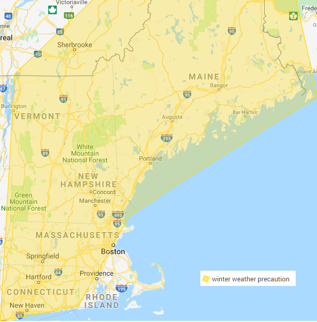
Winter weather precaution from 3am to 1pm Friday. Do to the snowfall amounts now predicted less than 2 inches, there is not enough confidence in giving a winter weather advisory.
Level 1. road conditions. through all of southern New England. Areas of level 2 road conditions Friday morning. Areas of Slippery travel with secondary/untreated roadways being snow and or iced covered especially interior. Some limited visibility. Southeast mass is also included in this. Expect light delays do to the weather on top of regular Friday morning traffic.
For the Weekend
Winter weather precaution from Saturday evening through Sunday night. Please look at discussion.
An arctic front sent some clouds to the area with some isolated flurries. This arctic front will allow our first shot of cold air to set up a mostly sunny and chilly Thursday. A disturbance will travel from the southern/central Rockies to the central plains up into the Ohio river valley and will send a period of snow and rain showers for Friday morning. For a period it looked like a more organized system was possible but it looks like it will be dissipating as it crosses the region. Snowfall amounts will be 0-2 inches isolated amounts of 3 inches are possible in the higher elevations. The problem is not necessarily the snowfall amounts its that it looks to start pre-dawn Friday and go through mid-day impacting the morning commute. There will be only coatings as you head south and east of Boston as there will be more rain showers. Cold air will re-filter into the region Friday night and Saturday with highs in the 20s and 10s for lows. Clouds will be on the increase Saturday ahead of our next area of low pressure.
The weekend storm still has lots of questions but we should get at least a moderate impact event. The parts are still off the west coast and we won’t have a very good idea until tomorrow/Tomorrow night and even then we probably won’t know all the details till Friday or even Saturday as this is a tricky set up.
What we do know.
Big storm thats not going to be a nor-easter as this is a low that will be traveling along a boundary. There is a lot of moisture to work with. There is a lots of cold air to play with. At the same time there will be warm air to the southeast.
What we need to still figure out
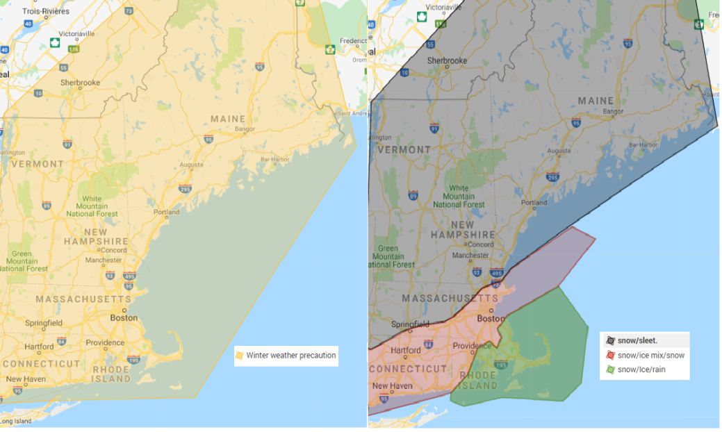
We do not know the tract and how far north does the warm air above goes. Another question is how stubborn the cold air would be. Snowfall amounts is track dependent and how much warm air moves in aloft and how far north does it go. With that said the map above to the right shows a generalized early idea on the precipitation make up. This will change as we get closer to the event. There is a risk of an ice event especially in the area shaded in red and away from the coast. Many of the models this afternoon shifted east continuing the overnight trend, but some did move back west. This just tells you that there are still several possibilities on the table still. Everyone should end as a period of snow as temperatures crash as the low pressure slides out of the region. Any where that changes to ice/rain will see everything freeze up like a rock Sunday night, continuing the hazardous weather. We will get a better handle on the weekend system by tomorrow night.
Forecast for the Merrimack Valley.
Tonight. Becoming mainly clear, lows in the low to mid 10s.
Thursday. Increasing clouds, highs in the low to mid 20s.
Thursday night. Increasing clouds, chance of snow showers late. Lows in the low to mid 10s
Friday. Snow showers in the morning, Chance of rain showers. Highs in the low to mid 30s. Total snowfall accumulation 0 to 2 inches.
Friday night. Partly cloudy, lows in the mid to upper 10s
Saturday. Increasing clouds, highs in the low to mid 20s.
Saturday night. Snow developing. Lows in the 10s
Sunday. Snow, sleet and freezing rain. Highs in the mid 20s to low 30s. Becoming breezy.
Sunday night. Snow and sleet likely in the evening Mostly cloudy, becoming clear late. lows around zero. Breezy. Flash freeze.
MLK day. Mostly sunny Breezy. highs in the single digits to low 10s. Wind chills below zero.
Monday night. Mainly clear, lows around zero.
Tuesday. Mostly sunny, highs in the low to mid 20s.
Tuesday night. Mainly clear lows in the 10s.
Wednesday. Increasing clouds, highs in the low to mid 30s.
Storm updates for tomorrow and then the usual evening update.
